Things to Do in Khevsureti, Georgia: Itinerary + Travel Tips
20 min readA complete travel guide for Khevsureti, including a 3-day itinerary for Shatili, Mutso, Pshavi and beyond.
Combining the scenery of Tusheti with the cultural monuments of Svaneti – almost as accessible as Kazbegi, yet even more under-the-radar than Racha – Khevsureti might just be the perfect mountain destination in Georgia.
Known as the ‘Land of Valleys’, Khevsureti is a historic highland region in the Greater Caucasus north-east of Tbilisi. Its fairytale-like landscapes, medieval towers and evocative stories of courageous warriors have earned it pride of place in Georgian folklore. Yet many visitors to Georgia overlook it.
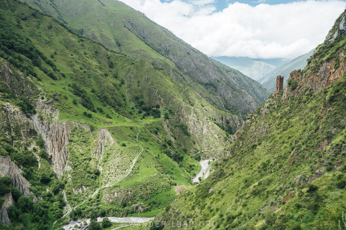
I finally got my chance to visit Khevsureti this summer on what I know will be the first of many trips. My Khevsureti itinerary and travel guide brings together all the best things to do in the region, including historic towers and other cultural sites, day hikes, and culinary experiences.
Please note: This post contains affiliate links, meaning I may earn a commission if you make a purchase by clicking a link (at no extra cost to you). Learn more.
Briefly about Khevsureti
Located in Georgia’s mountainous north between Kazbegi and Tusheti, Khevsureti is a historical province that is now part of the Mtskheta-Mtianeti Region.
Its southern border is drawn approximately 100 kilometres (62 miles) from the centre of Tbilisi, where the Aragvi River split into Pshavi’s Aragvi and Khevsureti’s Aragvi. To the north, Khevsureti borders the Republics of Ingushetia and Chechnya.
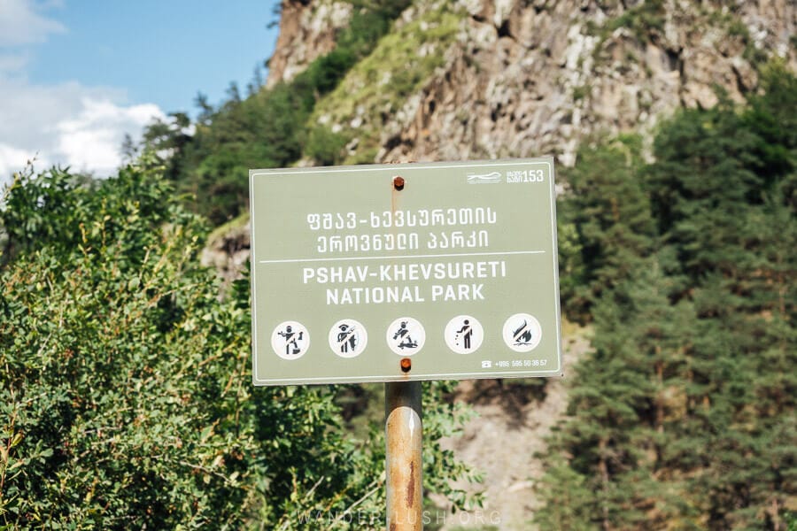
The region is divided into two parts: Piraketa (‘hither’) Khevsureti, and Pirikita (‘thither’) Khevsureti. Upper Khevsureti is known for the fortified villages of Shatili and Mutso, and the remote villages of Ardoti and Khonischala, while Lower Khevsureti is associated with Korsha and Roshka.
High mountains separate them, with just one road leading into Khevsureti via the Datvisjvari (‘Bear’s Cross’) Pass.
Cradle of Warriors
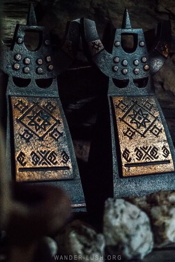
Khevsureti is known for its heroic warriors. In the past, the Khevsurs played an incredibly important role in safeguarding Georgia’s north-eastern frontier from invaders. This tradition continued into the early 20th century, and it’s said that in 1915 a band of Khevsur men rode into Tbilisi dressed in rusty chainmail ready to lend their archaic broadswords to the WWI effort.
The theory that the Khevsurs were descended from a lost tribe of Crusaders has been disproven, but it’s still an interesting one.
Fiercely independent, Khevsurs were punished in the Soviet period for their insubordination and many families were forcibly relocated to the lowlands. This led to several villages being abandoned.
Their courage, chivalry and spunk is remembered in the fantastic poetry of Vazha-Pshavela and in many a folk ballad.
Tales of Towers
As the name ‘Land of Valleys’ suggests, Khevsureti is all high mountains and deep gorges. The warriors might be gone, but their solitary watchtowers and fortified villages still stand watch over the hills.
Though maybe not as dramatic as in Tusheti, the high mountains here are incredibly picturesque and add to the area’s remote feel – especially once you cross the Datvisjvari Pass and enter into the deepest part of the region.
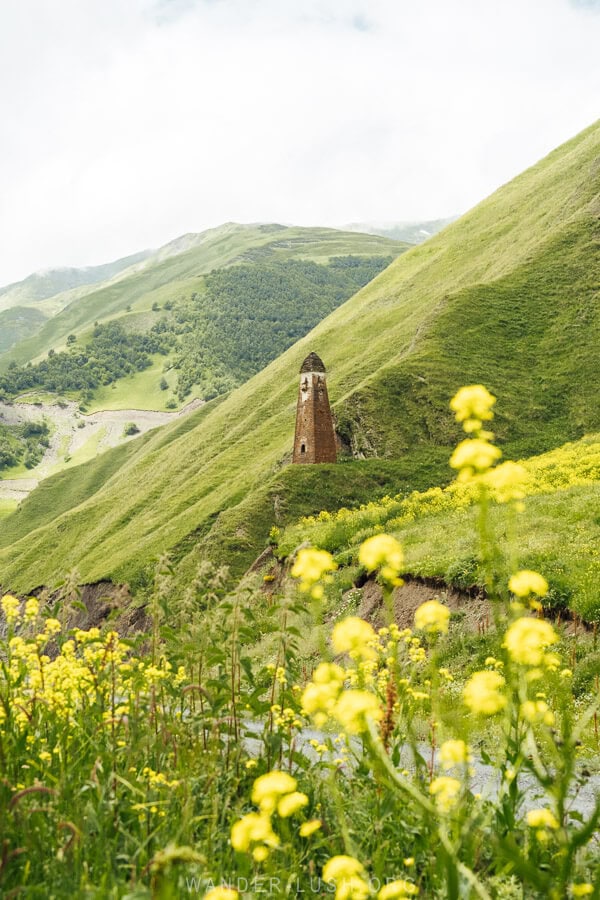
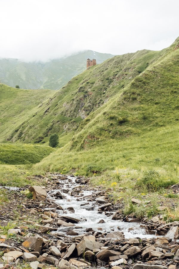
Khevsureti is known for its hiking trails, particularly as the finishing point for the Omalo-Shatili trail. But its cultural monuments are every bit as attractive as its landscapes: Defensive villages, burial crypts, Khati and Salotsavi sacred places that reflect the intermingling of pre-Christian and Orthodox beliefs.
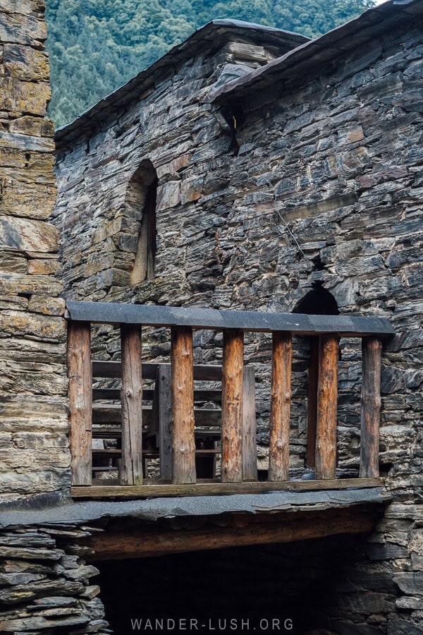
Shatili, a Tentative UNESCO World Heritage Site, and the incredible fortified village of Mutso have both been heavily restored, along with a number of towers dotted around the valleys. These vary from short and stout square-based residential towers, divided into multiple levels for a family to keep their livestock and their living quarters, to defensive Vainakh-style towers. Most date to the 15th-17th centuries.
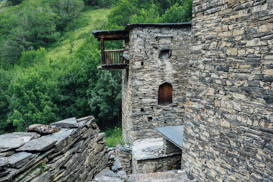
In Shatili, you will see many special architectural flourishes including pictogram engravings placed above the doors and windows, and elevated platforms made of logs (the inspiration for the design of the Saburtalo Skybridge in Tbilisi).
Land of Legends
There are numerous legends that originate in Khevsureti and are tied to the region’s belief system and code of conduct. Most famously there is the concept of stsorproba, where the chastity of young couples is tested by placing a dagger in their bed. Another legend says that a kerchief cast by a woman between fighting Khevsur men should put an immediate stop to the fray.
Home of Khinkali, Kuserbo & Dambalkhacho!
Khevsureti has a unique and delicious local cuisine. Like most mountain fare, it is heavy on carbs and dairy. No-frills khinkali with a pure beef filling (pork is not consumed in the villages), kuserbo, a delicious fry-up of potato, cheese and ghee, and dambalkhacho, a mild aged cheese, are all among the Khevsurian delicacies you can try when visiting.
When is the best time to visit Khevsureti?
Khevsureti is closed off in winter (approximately from October to May) and opens for the season in June. We visited in late June, when the landscape was still very green and the wildflowers were out. It was a little bit rainy, however, so I recommend visiting in July/August, when conditions are more likely to be dry and the road safer.
You might want to time your visit to coincide with a local festival. The Mountain Days Festival is a new initiative that takes place across Georgia’s different highland regions. In 2024, it was held in Shatili on the second weekend of July. Shatiloba or the ‘Day of Shatili’ takes place on the first or second weekend of September. Find more details in my Georgia Cultural Calendar.
It is noticeably busier in Shatili and Mutso on weekends. If it is important for you to experience the area with fewer people around, try to go on a weekday.
How to get to Khevsureti & how to move around
If you want to fully experience Khevsureti you will need to travel by car. Public transport (marshrutka van) is available, but it can only take you as far as Shatili.
The road to Khevsureti is definitely not as bad as the road to Tusheti. But it is still an unsealed, narrow, windy mountain road that is prone to mudslides. A 4WD (preferably an off-road vehicle) is mandatory for visiting the places mentioned in this itinerary.
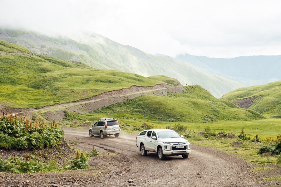
I recommend travelling with an experienced driver who is familiar with the area. If you need a recommendation, feel free to get in touch via email and I can refer you to the driver we used for our trip.
For a detailed break-down of the different transportation options, including details about the marshrutka service and tips for self-driving, see this guide: How to Get to Shatili from Tbilisi (published soon).
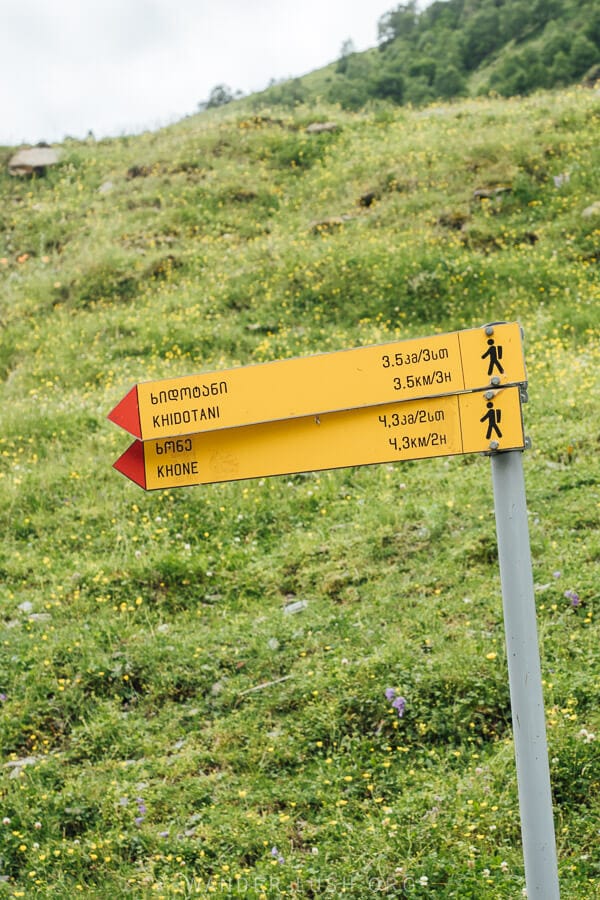
Approximate travel times in Khevsureti
- Outskirts of Tbilisi to Korsha: 1.75 hours
- Korsha to Roshka & the Abudelauri Lakes trailhead: 40 minutes
- Korsha to the Datvisjvari Pass: 50 minutes
- Datvisjvari Pass to Shatili: 1.5 hours
- Shatili to Mutso: 45 minutes
- Mutso to Khonischala: 20 minutes
Where to stay in Khevsureti
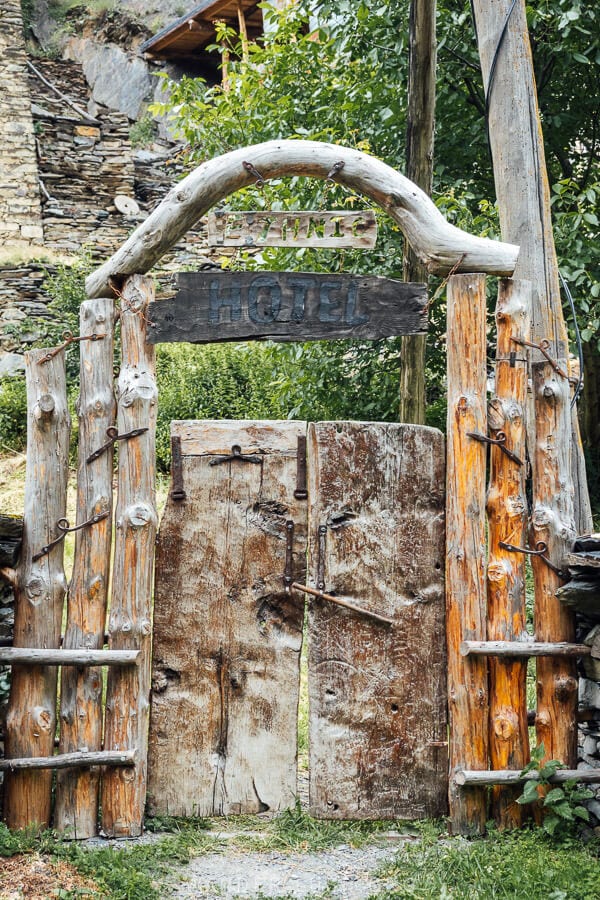
Ethnic Hostel (Shatili)
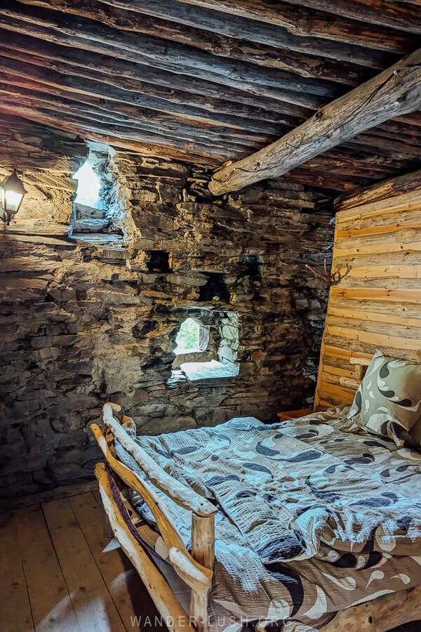
Managed by the charming Irma and her family, Ethnic Hostel (less like a hostel and more like a guesthouse with a shared bathroom) is set inside a reconstructed tower-dwelling adjacent to the main village. We tossed up between this hotel and Front Castle, but decided on Ethnic in the end because of the view: from the rooftop terrace you can see all of Shatili, rather than being inside the village with not much of a view. Not to mention that prices at Front Castle were almost double.
We booked all three rooms – the double, twin and a room with a bunk that sleeps three. The tree-trunk bed frames and all the rest of the furniture was handmade by Irma’s husband. Rooms are very quiet, clean and comfortable, and the breakfast is great.
Guesthouse Grilo (Khonischala)
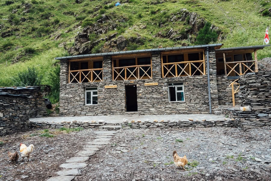
We were lucky enough to be the very first guests at this new guesthouse in Khonischala village. Its location close to the Atsunta Pass is very convenient for hikers, and it’s a great place to spend a quiet night if you want to go deeper into Khevsureti then get those magnificent views of Mutso from afar when driving back the next morning.
Ardoti Guest House (Ardoti)
A favourite among hikers, this guesthouse in Ardoti is another option for staying on the far-eastern side of Khevsureti past Mutso.
Check prices & availability here on Booking.com.
Korsha Guest House (Korsha)
This popular family-run guesthouse is located in Korsha village, before the pass, and is easy to reach from Tbilisi via a mostly sealed road. The owners manage a small ethnographic museum in the village. This is a good base for overnighting before or after the Abudelauri Lakes hike.
Day 1: Korsha, Roshka, the Abudelauri Lakes Hike & Khonischala
Days 1 and 3 of this Khevsureti itinerary are weather-dependent and can easily be interchanged depending on what gets thrown at you. If conditions are favourable, then I recommend you prioritise the hike before crossing the Datvisjvari Pass into Upper Khevsureti in the late afternoon.
Tempting as it might be to make all your photo stops on the way into Khevsureti, it is best to save your sightseeing for the return journey. If you leave Tbilisi early and complete the hike efficiently, then you might have time for some or all of the road stops listed below under Day 3.
The road to Khevsureti
If you are starting from Tbilisi, set off before 8am to try and beat the worst of the traffic.
The first part of the journey to Khevsureti follows the Georgian Military Highway as far as Zhinvali. We actually started from Kazbegi (Stepantsminda). We took the first marshrutka of the day at 7am and requested to get dropped off in Zhinvali (roughly 2 hours travel time), where we met up with our driver who was coming from Tbilisi.
This petrol station in Zhinvali has an excellent bakery attached where you can buy house-made meat and potato pastries (the ideal breakfast!). They also have coffee and a shop where you can stock up on basic snacks and bottled water for the hike.
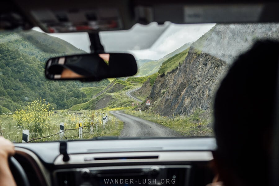
Turn off the main highway at Aranisi to join the Zhinvali-Barisakho-Shatili Road, which will take you all the way to Upper Khevsureti. The first part of the road follows the eastern branch of the reservoir and is incredibly beautiful, with water views the whole way. It is a very good (newly sealed) road. Don’t let it lull you into a sense of false security, though – it only gets rougher from here!
The road leads through Pshavi (another historic region that we will come back to on Day 3) before the river divides and you start your ascent into the mountains.
Korsha
The first big Khevsur village we encountered was Barisakho. This is a large settlement with an auto service shop and a boarding school, where children from the surrounding villages come to study.
A little further along the highway, Korsha village is a tiny cluster of houses with what else but an old helicopter parked in the centre (I will have to return to find out what that is all about).
There are several guesthouses in Korsha – including the famous Korsha Guesthouse. If you want to reduce your travel time on this day, you could spend the night here after the hike.
Korsha also has a small Ethnography Museum housed inside a reconstructed stone tower. The owners of Korsha Guesthouse curated the museum and hold the keys. They will happily show you around.
Roshka
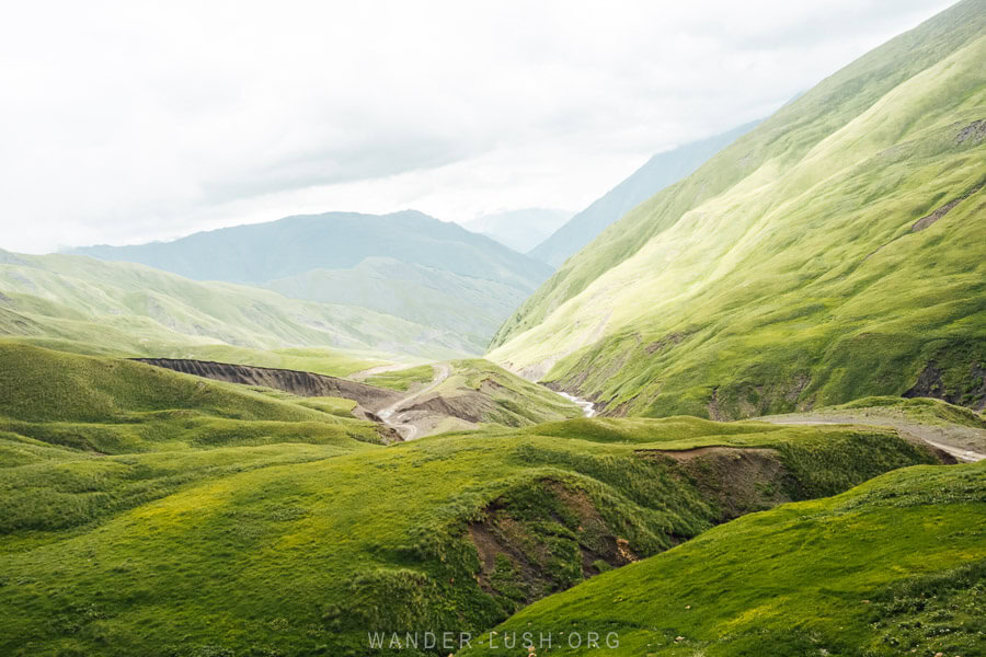
You will notice on Google Maps that Roshka village is marked just after Korsha. This is incorrect. To reach Roshka and the trailhead for the Abudelauri Lakes hike, you need to drive a further 7 kilometres along the main road to Ghelisvake, then take the turnoff at this point.
Follow the switchback road off the highway (it is not recognised on Google Maps), then continue for around 40 minutes to reach Roshka, which is perched much higher in the mountains. This road is particularly bad – the worst we encountered in Khevsureti – but work was being done at the time of our visit, so it looks like it will be sealed or at least gravelled in the near future.
Hike to the Abudelauri Lakes
The dirt road through the forest will eventually bring you to Roshka village. In 2023, some improvements were made so that you can continue driving past the village to get closer to the trailhead for the hike. There is a small parking area around this point where it is safe to leave your car.
If you were to continue down this rough road, you would eventually reach the village of Arkhoti – a place previously only accessible by heli or by horse. The Abudelauri Lakes trail opens up to the left, just past the parking bay.
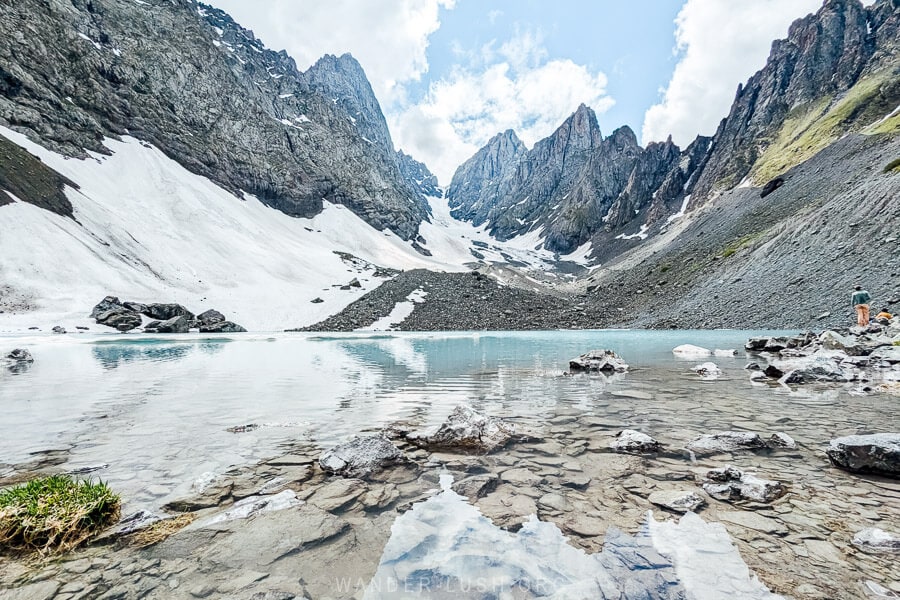
This day hike is a spectacular introduction to Khevsureti. The first half of the walk follows newly marked trails (over newly built bridges) across the valley floor before you start ascending towards Mount Chaukhi – AKA the Georgian Dolomites – to find the trio of colourful alpine lakes scattered at its base.
We had just seen Chaukhi from the opposite side when hiking in the Juta Valley near Kazbegi. The hike from Roshka has a higher elevation and is more challenging in terms of both distance and terrain. But the views are absolutely incredible.
The toughest part of the hike is the final push to the White Lake, followed by an impossibly steep descent over shale rock to the Blue Lake. Unfortunately for us we got caught in a storm so we never made it to the Green Lake.
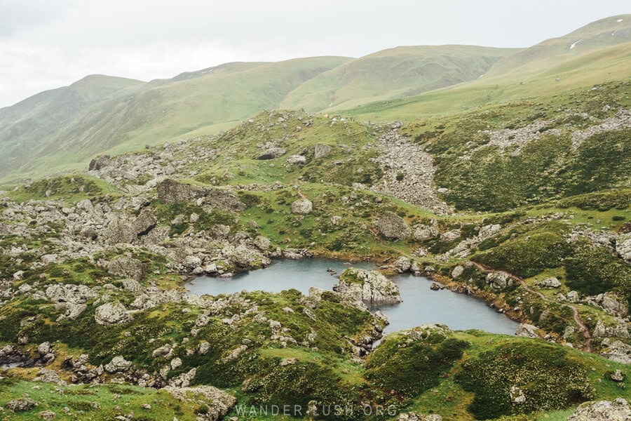
The route then loops back through the valley to deliver you back to the carpark. All up you should allow a minimum of 6 hours to comfortably complete the hike.
For more tips, see My Short Guide to the Abudelauri Lakes Hike (published soon).
Khonischala
After the hike, return to rejoin the main road by travelling back down through Roshka the same way you came. After Korsha, the road turns from cement to compacted gravel and remains that way for the remainder of the journey.
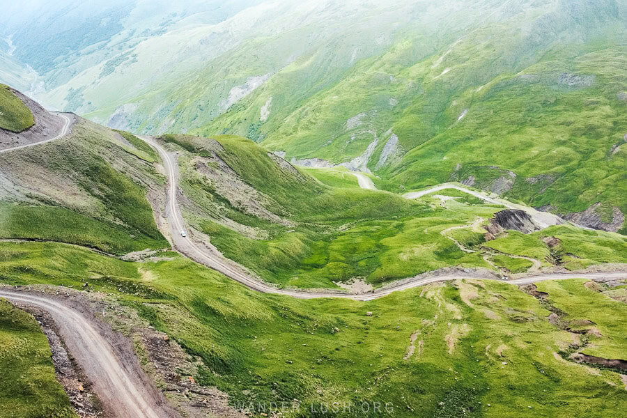
From this point it takes around an hour to reach the Datvisjvari Pass, then another 2.5 hours to reach Khonischala. I only recommend continuing over the pass into Upper Khevsureti if you have plenty of daylight remaining. This is not a drive you want to do in the dark, so if the hike takes you longer than expected or you encounter bad weather, you should stay in Roshka or Korsha and continue to Upper Khevsureti the next morning.
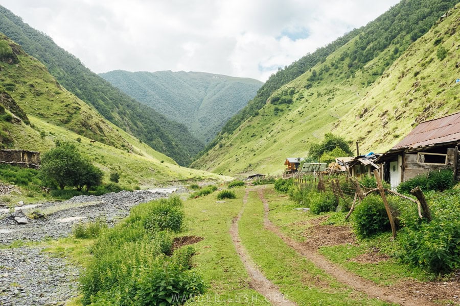
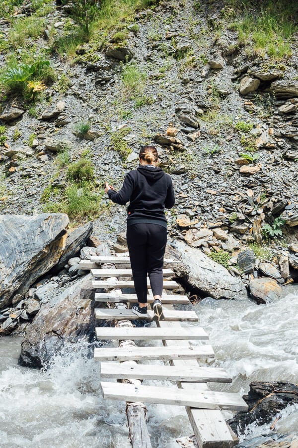
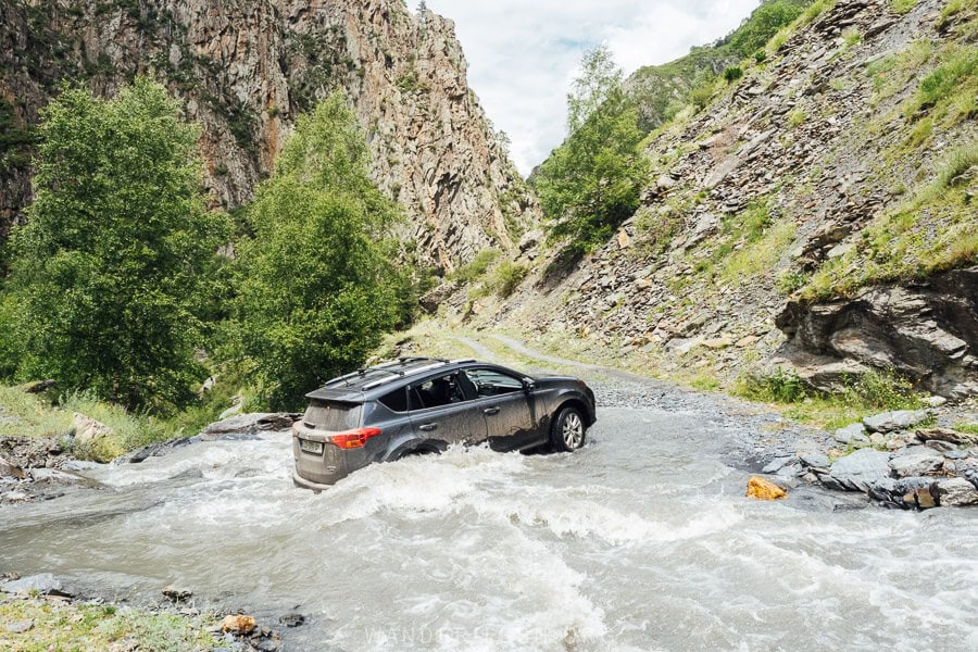
We cut it very fine and ended up arriving at our guesthouse well after sunset. Luckily we had an expert driver behind the wheel who managed everything perfectly, even a late-night river crossing! Unfortunately there is no car bridge across the Khomistskali River, so it is necessary to drive through the river at this point (passengers can leave the car and cross the small pedestrian bridge by foot). By the time we left the village the next morning, the water level had dropped significantly.
We made it to our guesthouse in Khonischala in time for dinner. We were very lucky to be the first guests at the newly opened Guest House Grilo, and our host’s aunt, Lia Deida, treated us to a feast of handmade khinkali.
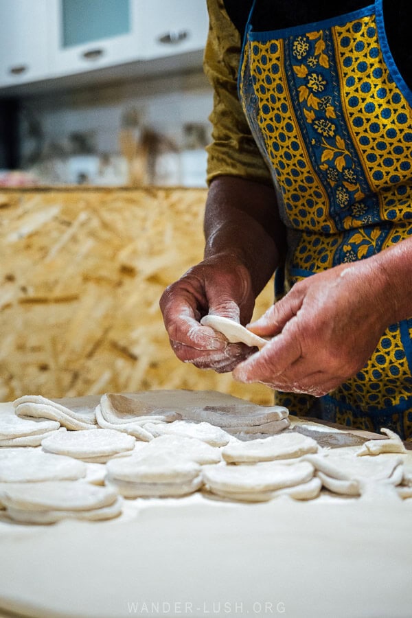
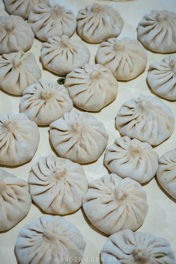
The following morning she showed us her garden and apple trees as we made our way around the tiny village.
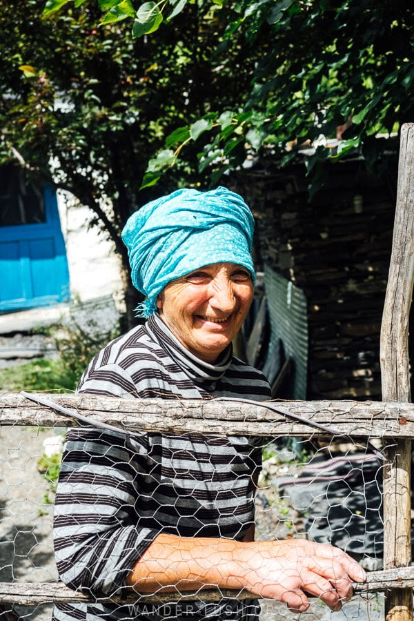
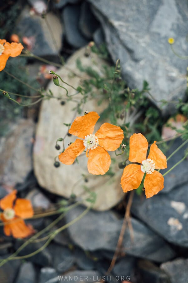
There are only a handful of houses in Khonischala, all belonging to members of the Shetekauri family who settled this area generations ago.
The location right on the river is idyllic. We stood outside on the terrace with a coffee and watched as hikers fresh from crossing the Atsunta Pass made their way along the path in front of the house.
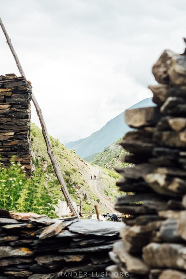
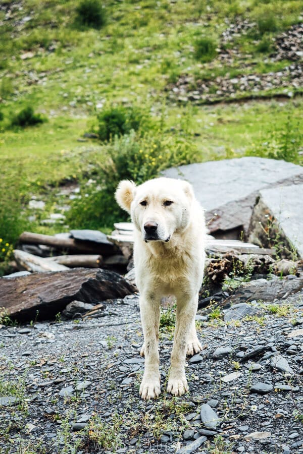
It was nice to experience a little slice of small village life and see a more remote side of Khevsureti away from the main tourist attractions. Another bonus of staying the night in this area was approaching Mutso from the south the next morning, which affords amazing views of the fortress-village.
Day 2: Mutso, Anatori & Shatili
On Day 2, visit the three most important historic sites in Khevsureti: the fortified villages of Mutso and Shatili, and the Anatori Crypts. If you are starting in Khonischala, distances are very short so you will have plenty of time for an easy afternoon in Shatili, where you should also spend the night.
Mutso
The previous evening it had been too dark to see Mutso as we passed the hilltop village on our way into Khonischala (and honestly, I think I was asleep by that stage). So when we spotted the stoney towers perched like a bird’s nest on a high ridge the next morning, it was a pretty special moment.
Mutso (Mitsu) is just 3 kilometres from Khonischala. As you drive in from the south, there are some great photo opportunities along the road to capture the village framed between the mountains.
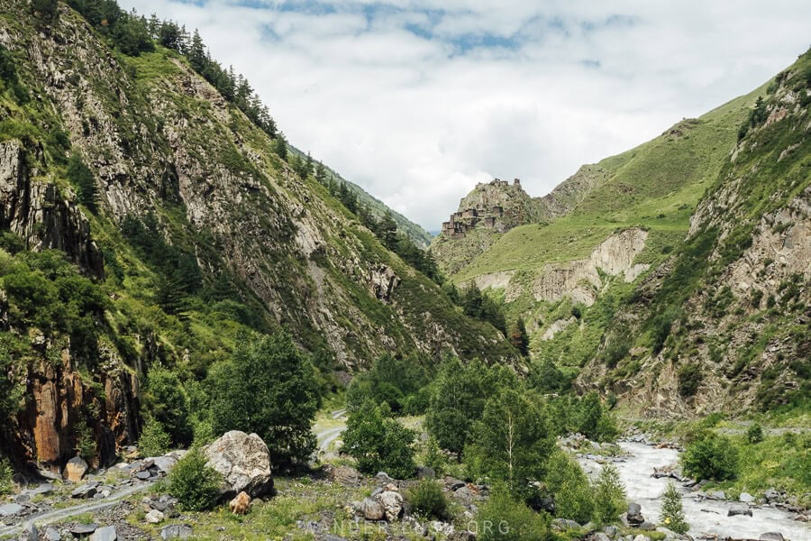
Mutso is a fortress where the 30 or so tower houses are interlinked to form one long defensive chain. This method was so effective, Mutso was once considered to be the most robust fortification on Georgia’s north-east frontier.
To reach the village, you must park on the roadside in front of the cafe and climb up a marked path for around one kilometre. Various crypts and shrines are dotted along the hillside and can be visited on the way up. To reach the highest point of the village and a 360-degree view, you have to scramble up a vertical rocky path.
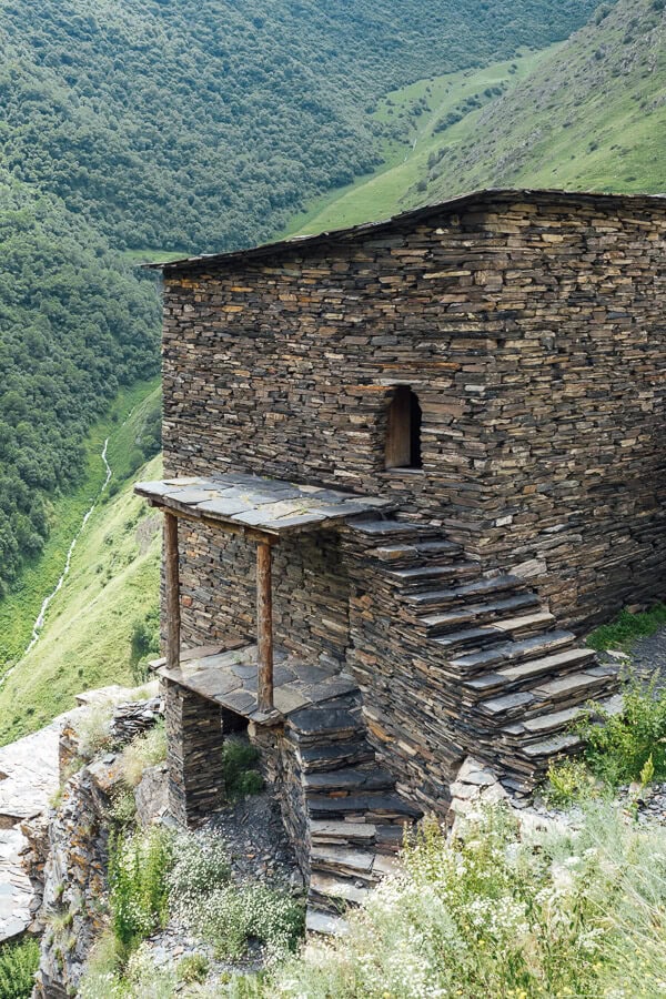
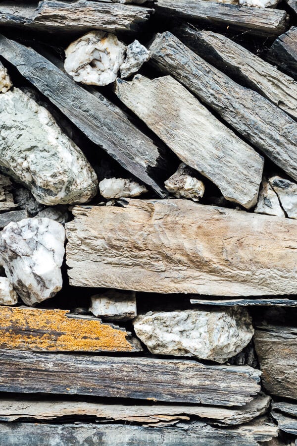
The village was almost entirely rebuilt from rubble as part of an award-winning rehabilitation project that commenced in 2014. The 30 flat-top towers are all empty for now, but their interiors have also been restored. Venture through any of the open archways to see the wooden beams and platforms that traditionally divided the dwellings into different spaces for animals and humans.
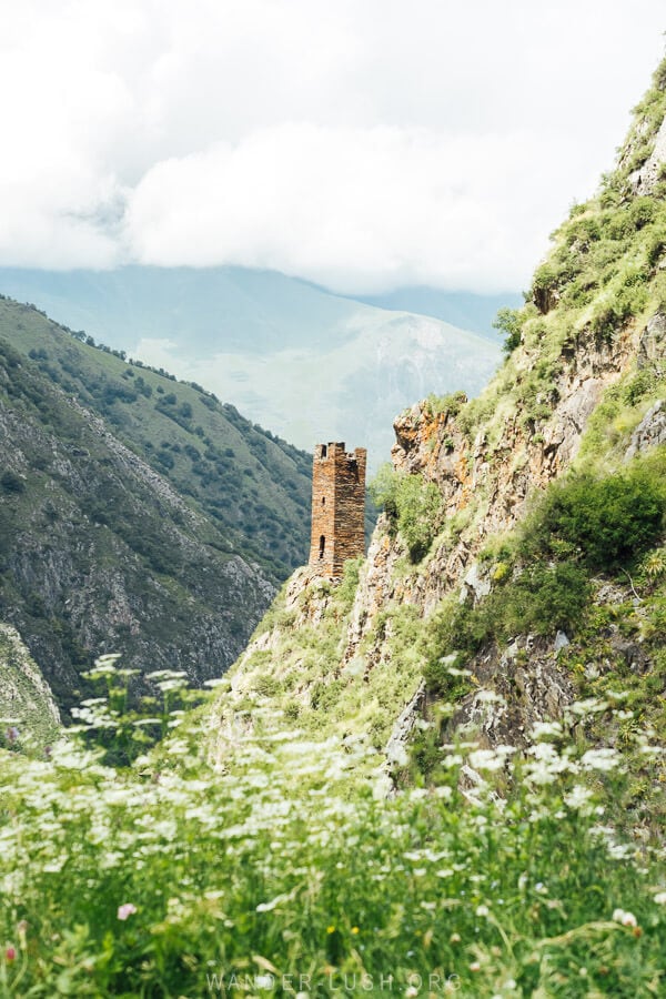
You will notice several defensive towers in the area including the picturesque Torghva’s Tower, which appears on the opposite side of the valley as you round the first incline.
Give yourself at least 2 hours for the hike up and back, with plenty of time in the fortress for exploring the towers and taking photos.
For more tips, see My Guide to Visiting Mutso.
Anatori Necropolis
The Anatori Necropolis is located between Mutso and Shatili, so it makes sense to stop off on the way. It is a very small site so you only need around 20 minutes here.
The trio of concealed burial chambers is all that remains of Anatori, a once-prosperous village located on the opposite side of the valley. It was depopulated in the 18th century when the Great Plague or Zhami swept through the area, apparently claiming the entire community.
At first, residents of Anatori built this ossuary to house their dead. But when they realised the severity of the contagion, they started walking themselves to the necropolis where they would sit and wait for death to come. Only one resident – a young boy who was away working as a shepherd – survived to tell the tale.
This story of self-sacrifice is one of the most potent myths associated with Khevsureti.
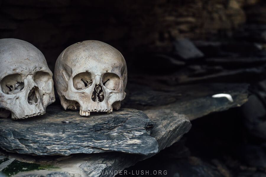
The crypts themselves are three low stone buildings arranged over the valley edge. Peering into the darkness through the barred windows, you will see piles of human bones (no sculls like in Mutso, though) scattered on the floor and arranged over ledges. A flat piece of slate engraved with a cross, a shrine of sorts with votive candles and coins on it, is balanced on one of the sills.
To add to the eeriness, Anatori is less than a kilometre from the Russian border. This is the closest I have been to Russia – it was pretty surreal to see the flag flapping in the wind in the distance.
There was a time not so long ago when borders were more porous and pilgrims from the North Caucasus would cross the pass and gather here to worship Anatorisjvari, the local deity who is believed to have set the Plague upon the village.
Shatili
A full afternoon and evening (plus the following morning) is the perfect amount of time for Shatili. We arrived at around 3pm and after checking into our hotel, had plenty of daylight left to explore.
Shatili is the biggest village in this part of Khevsureti. Like Mutso, it is a fortified village of tower-dwellings – but Shatili by contrast is still lived-in. An increasing number of towers have been rebuilt and retrofitted as guest houses and cafes.
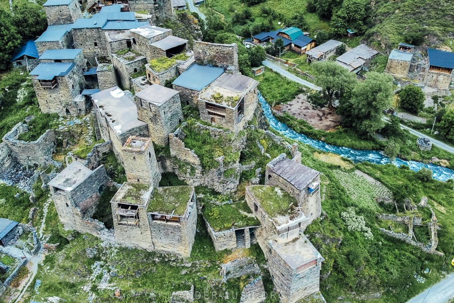
Walk between the towers and search for pictograms, symbolic engravings placed on the window or door mantle to protect the family within. Stop at Cafe Firefly for a drink overlooking the rooftops and maybe a plate of kuserbo, a local delicacy of potato, cheese and ghee. Continue up to the Orthodox Church, then walk out to the bridge for a view of the towers stradling the river.
For more things to do, see My Shatili and Anatori Guide.
We had a very comfortable night’s sleep inside our tower lodging in Shatili, Ethnic Hostel, and were treated to a beautiful breakfast the next morning courtesy of our host, Irma.
Day 3: Pshavi & sightseeing on the Datvisjvari Pass
On the way back down, stop off at the various points of interest along the road including the Datvisjvari Pass itself. You will pass through a second historic region, Pshavi, before rejoining the Georgian Military Highway to drive south to Tbilisi or north to Kazbegi.
Guro’s Tears
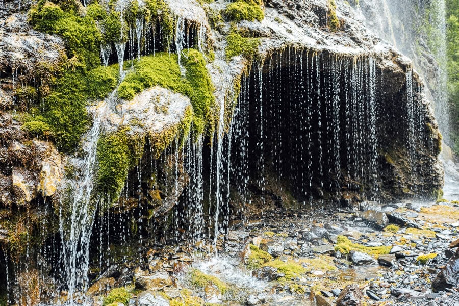
Guro’s Tears (Guro’s Natsveturi) is a striking waterfall and shallow cave located right on the roadside outside Shatili. The mossy rock wall perpetually drips with spring water.
Lebaiskari Tower & Kistani Fortress
Located in valleys off the western side of the road as you leave Shatili, Kistani and Lebaiskari are two long-abandoned Khevsur villages.
Kistani Fortress is a set of two ruins perched atop green hills. With a stony river flowing at its feet and big leafy trees dotted along the valley, it is incredibly picturesque.
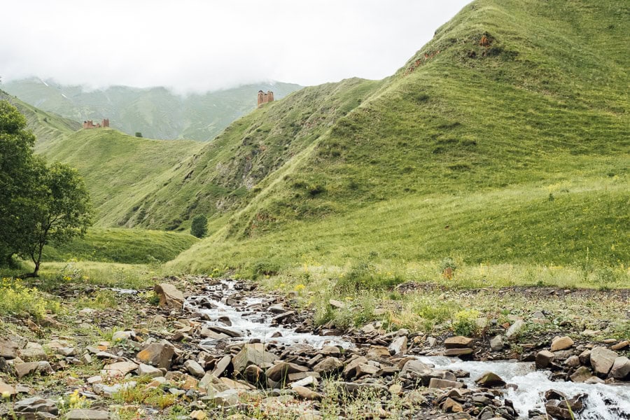
We didn’t have time to hike out to the fortress but I would love to come back and explore the area more thoroughly at a future date.
Lebaiskari Tower is closer to the road and easier to see. It is a great example of a Vainakh tower, which has a tapered silhouette and is topped with a little shale roof. This sort of architecture is prevalent across this part of the Caucasus and can also be found in Chechnya and Ingushetia.
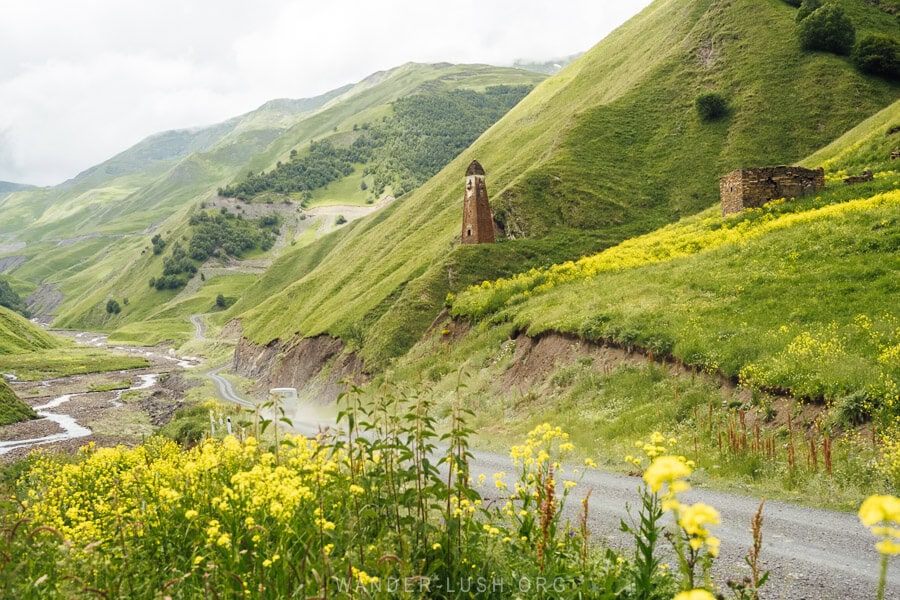
Pull off the highway before Lebaiskari for a nice view of the tower and the ribbon-like gravel road winding its way down into the valley. I got very lucky with my timing and managed to snap a photo of a Buhanka van kicking up a cloud of dust as it lumbered past the tower. A few other crumbling stone structures can be seen in the vicinity.
The Datvisjvari Pass
Located 2,600 metres above sea level, the Datvisjvari or ‘Bear’s Cross’ Pass is the highest point on the road to Khevsureti. Apparently it’s a tradition to stop here, crack open a bottle of chacha and eat some snacks… If you prefer to remain sober (highly recommended), you can pull over and go for a walk instead.
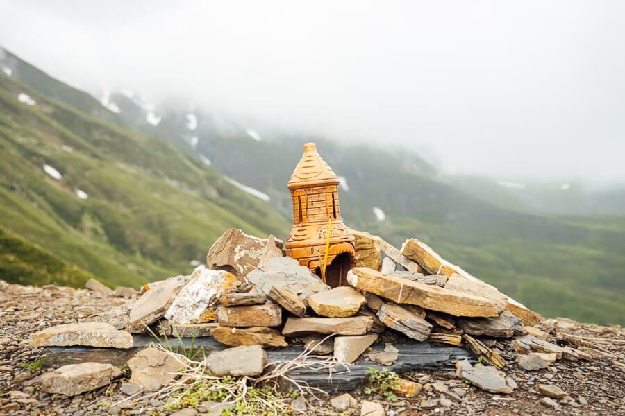
The pass was shrouded in fog when we arrived. There are small shrines scattered around the place and a few picnic tables. It’s possible to walk further up to the highest point of the pass where there is a three-pronged metal cross.
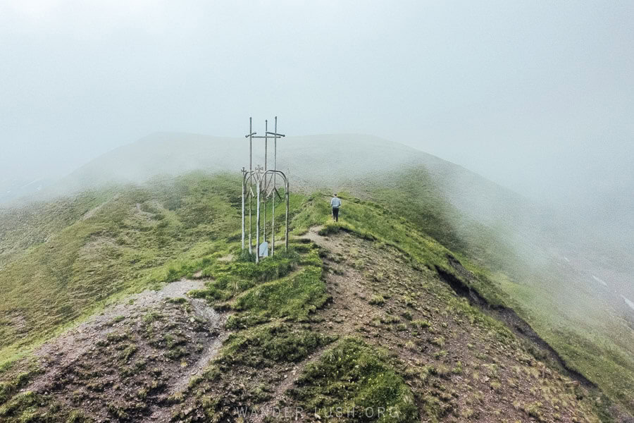
The views looking back down over the road towards Shatili and out towards the next stage of the drive towards Korsha are phenomenal.
Vazha-Pshavela House Museum
After rejoining the ‘good’ road in Korsha and officially exiting Khevsureti, you will drive into Pshavi, another historic highland area that is culturally and geographically distinct from its neighbours.
Luka Razikashvili, better known by his pen name Vazha-Pshavela, is a hero of Georgian literature. He was born in Chargali village in 1862, and maintained a very close relationship with Pshavi throughout his lifetime. Many of his poems and stories reference the legends and real-life heroism of warriors from Pshavi-Khevsureti.
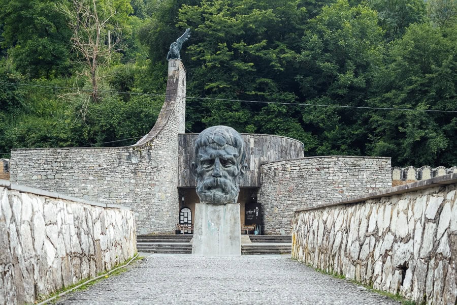
In 1961, his former residence was transformed into a house-museum. A second Soviet-style building was erected adjacent to the old house to display a collection of memorabilia.
We were passing on a Monday, and unfortunately like all National Museums in Georgia this one was closed. But it was still worth stopping to admire the architecture.
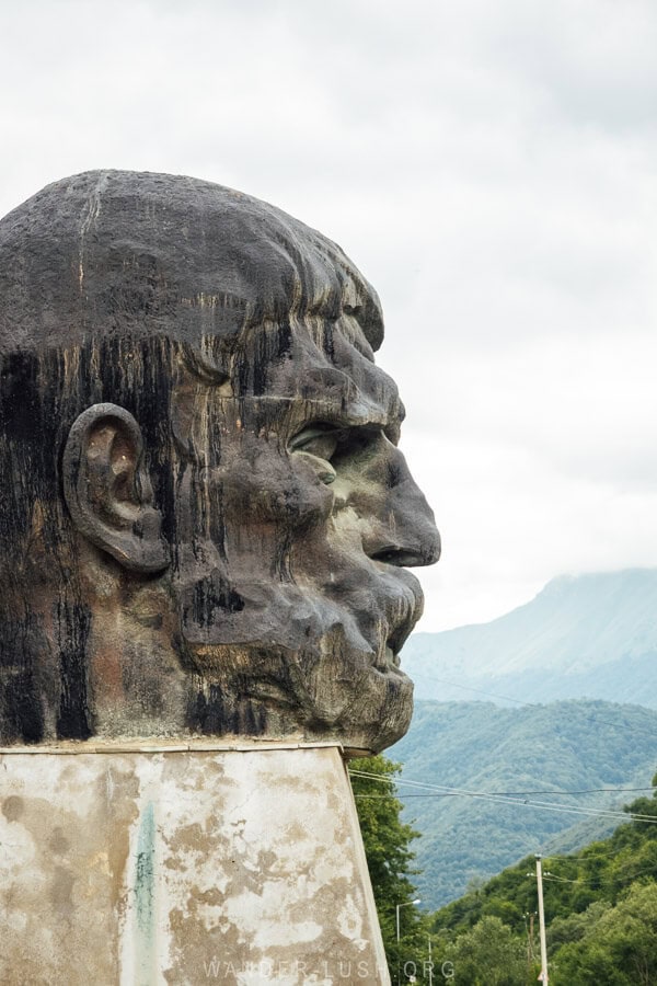
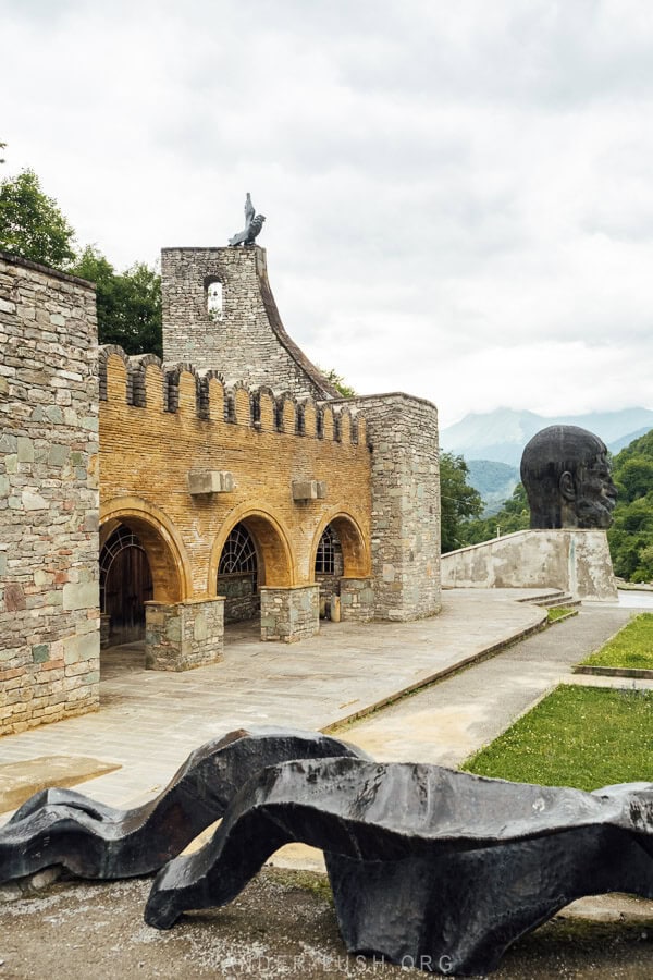
The main museum building is quite something – the rounded forms mirror other Brutalist architecture in Georgia but the use of local stone is quite unique. Adjacent, a small amphitheatre is bordered by an usual metal ensemble, and a giant sculpture of Vazha’s distinctive profile stands guard at the entrance.
I imagine the interior of the museum building is also quite interesting. I will be back for a proper visit soon. The museum’s opening hours are 10am until 6pm, Tuesday to Sunday. Entrance costs 2 GEL.
Pshauri Balada
Along with the poet-son of Pshavi, Vazha, this region is famed for its khinkali (like Pasanauri village on the road to Kazbegi, Pshavi claims to be the birthplace of the dumplings). There are half a dozen khinkali restaurants located alongside the road in the villages of Kalilo and Sharakhevi.
We chose Pshauri Balada for an early lunch – according to our driver who is very experienced with both Khevsureti and khinkali, this place serves the best dumplings. After eating half a dozen, I have to agree. The chewiness of the handmade dough and juiciness of the spiced filling was pretty special.
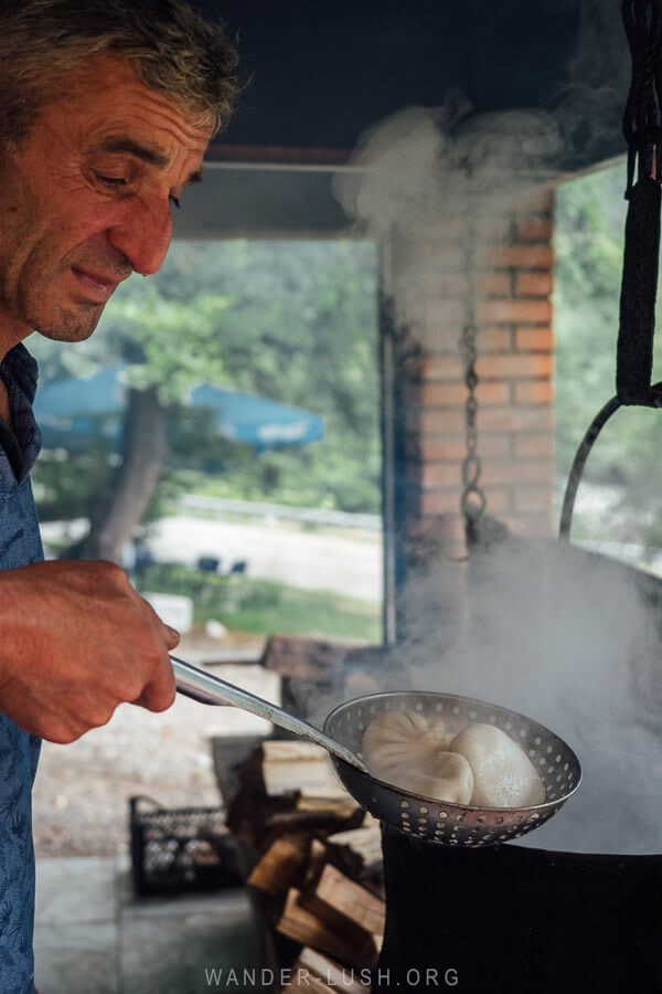
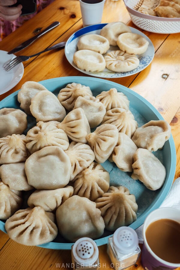
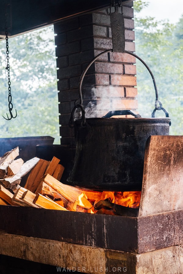
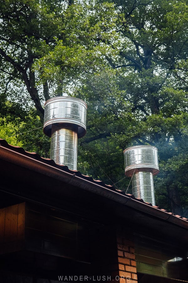
Unlike in Khevsureti where pork is not customary, in Pshavi the khinkali are made kalakuri-style with a standard 30% pork and 70% beef mix. What’s cool about these restaurants is that the khinkali are pinched to order and cooked in an outdoor kitchen. You can watch staff drop the dumplings into a big cauldron of rolling water hanging over an open fire. I have never seen khinkali made this way – it was very cool!
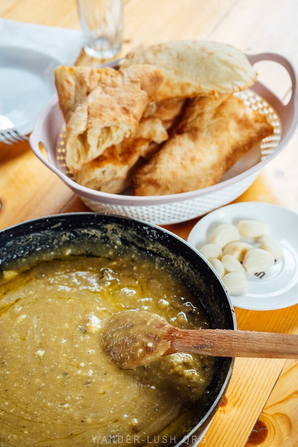
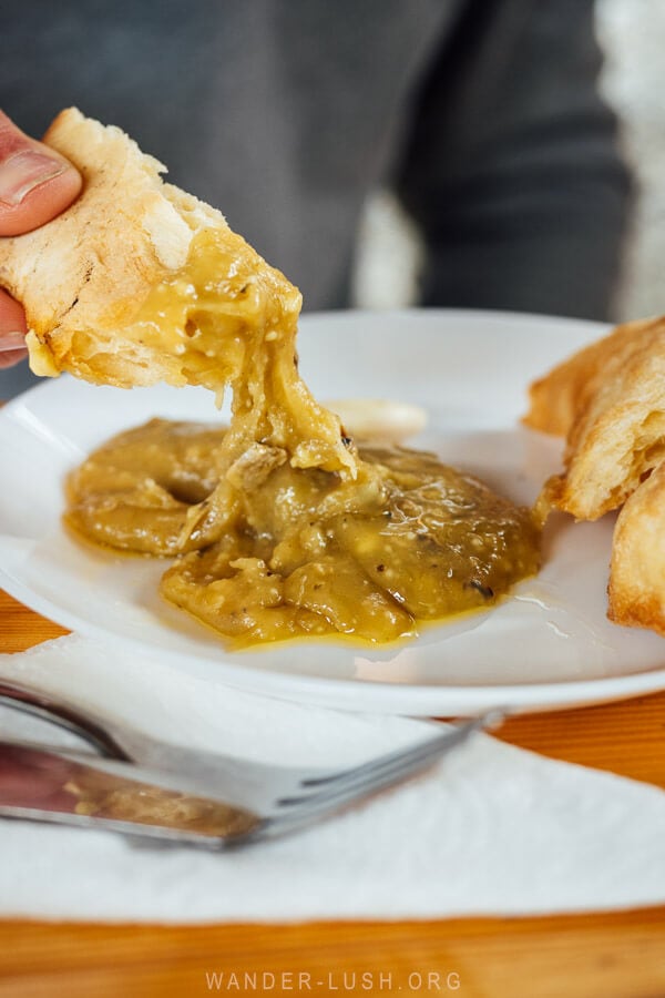
I also recommend trying the dambalkarcho aged cheese. We had it prepared karchoerbo-style, melted down with clarified butter to form a Georgian equivalent of cheese fondue.
You have to be quite efficient with your shoti bread dunking to scoop up the cheese while it’s still soft and warm. It is traditional to eat it with cloves of raw garlic on the side. The taste of dambalkarcho is quite mild and it has a beautiful texture.
We were the only table on a Monday, but I hear it gets very busy at these restaurants on weekends.
Khevsureti travel tips
- Being a remote mountain area, Khevsureti is a conservative place. Dress appropriately.
- I found Khevsureti a lot more laid back compared to Tusheti. For example, people might not eat pork but they don’t have a problem with guests bringing it into the village (though I still recommend you check first before you pack your jerky).
- Khevsureti is close to the border zone, but no permits or special permissions are required to visit the places mentioned on this itinerary. We had one (indirect) encounter with the border patrol when they phoned our guesthouse in Khonischala to ask if they were responsible for us.
- We noticed an almost complete absence of dogs in Khevsureti. We only encountered a couple of friendly dogs in the village and saw none on the hiking trails.
- Khevsureti is a relatively physically demanding destination that requires a fair amount of walking over rough terrain. Pack your good walking shoes and bring hiking poles if you have them.
- There are large parts of Khevsureti where you cannot get a phone signal, including on the road. You will not always be able to get online or make calls. Magti has fair coverage in Shatili and in Mutso. All guesthouses have WIFI, but it is of varying quality.
- While larger businesses might accept card payment, cash is king in Khevsureti. You will need to bring enough Georgian lari with you to cover your accommodation and food costs.
- There are no ATMs in Khevsureti. The closest cash point is in Zhinvali.
- Food options in Khevsureti are somewhat limited (outside of any special food places mentioned in the itinerary). I recommend eating your meals (especially breakfast) at your guesthouse.
- There are no shops or pharmacies in the area.
- Shatili and Khonischala have hydro power, so your guesthouse will have hot water and working charge points.


